Mapping Our Big, Wide, Wonderful World
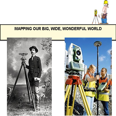
INTRODUCTION Professional surveyors measure, map, and analyze relatively large portions of the Earth’s surface. Armed with precision instruments, they define and record accurate land contours and property boundaries. And they pinpoint the locations of natural landmarks and man-made structures. Surveying has, for centuries, been an essential element of civilized human existence. But it’s practical, everyday […]
INTRODUCTION
Professional surveyors measure, map, and analyze relatively large portions of the Earth’s surface. Armed with precision instruments, they define and record accurate land contours and property boundaries. And they pinpoint the locations of natural landmarks and man-made structures. Surveying has, for centuries, been an essential element of civilized human existence. But it’s practical, everyday im-portance is often overlooked.
Accurate surveying measurements, and the maps that result, make individual property ownership possible. And property ownership, in turn, fosters fruitful human interactions, accentuates the steady accumulation of wealth, and en-hances social prosperity.
“Property is that which is necessary for all civil societies,” observed the famous Scottish philosopher David Hume. America’s 12th president, Abraham Lincoln, echoed a similar sentiment when he concluded that: Property is the fruit of labor . . . It is a positive good in the world. Journalist Leo Rosen was not inclined to contradict President Lincoln’s enthusiastic endorsement. “Property is a sacred trust,” he once concluded, “expressly granted by God, the Bible, and the Recorder’s Office.”
Compelling evidence that property boundaries were being established by sur-veyors as early as 1400 BC has been found among stone carvings found on the broad floodplains and the fertile valleys of ancient Egypt. During the Roman occupation of that prosperous and fertile kingdom, Roman technicians studied, absorbed, and copied the techniques the Egyptians had perfected while they were constructing the great pyramid at Giza.with its nearly perfect proportions and its surprisingly precise north-south alignment.
Around 15 BC, Roman engineers made at least one innovative contribution to the art and science of surveying when they mounted a large, thin wheel in barrel-fashioned on the bottom of a sturdy cart.
When their clever mechanism was pushed along the ground, it automatically dropped a single pebble into a small container with each 360-degree revolution. The number of pebbles rattling around in the container provided a direct measure of the distance traveled by the device. When perfected, it became the world’s first crude, but reliable, odometer!
Roman surveyors refined the methods and mechanisms pioneered by the Egyptians and used their techniques in surveying more than 40,000 miles of Roman roads and in laying out hundreds of miles of aqueducts funneling water to their thirsty cities.
SURVEYING INVENTIONS THAT SPROUTED UP DURING THE RENAISSANCE
In 1620 the famous English mathematician Edmund Gunter develop the earliest surveying chain. It was widely used by surveyors until the steel tape carne into existence 400 years later.
The vernier, a precise auxiliary scale that permitted more accurate readings of dis-tances and angles, was invented in 1631. It was followed by the micrometer micro-scope in 1638 and telescope sights in 1669. The spirit level followed around 1700.A spirit level relies on a small bubble floating in a liquid-filled glass cylinder that is precisely centered when the device is perpendicular the local direction of gravity. .
By the 1920s photogrammetry–the science of constructing accurate maps from aerial photographs–came into general use. And, 50 years later, in the 1970s, orbiting satellites began to serve as dedicated reference points for measuring millions of attitude angles and distances. These measurements allowed contem-porary experts to construct ground-level maps with unprecedented levels of accuracy and convenience. By the 1990s spaceborne centimeter-level surveying had become convenient, practical, and considerably less expensive, too.
Surveying methodologies can be divided into two broad categories: plane surveying – which typically involves distances shorter than 12 miles, and geodetic surveying–which spans areas so large the curvature of the earth must come into play.
PLANE SURVEYING
Plane surveying assumes that the earth is flat in a small local area. Under this con-dition, relatively simple computational algorithms from Euclidean geometry and plane trigonometry can be employed in processing the measurements the surveyor makes. The region being surveyed is typically divided into a small chain of triangles or quadrangles.
When the simpler triangles.are employed, the three interior angles for each tri-angle must sum to 180 degrees and the common side being shared by a pair of the adjacent triangles must be constrained to have the same length in both of the relevant trigonometric calculations. Specialized numerical adjustments force the computations to produce mutually consistent results.
The approach that relies on quadrangles involves four sides, eight angles, and two diagonals. All shared dimensions are forced to end up with mutually consistent results.
GEODETIC SURVEYING ON A MUCH LARGER. SCALE
Geodetic surveying must be applied when the areas being surveyed are so ex-tensive the Earth’s curvature has an appreciable effect on the surveyor’s measurements. In this case spherical trigonometry is required despite the fact that it involves greater complexity and more intricate visualization for those in-terpreting the results.
In 1687 Sir Isaac Newton demonstrated that the earth exhibits a pronounced bulge at the equator. Its first-order spherical shape is distorted by the centrifugal forces induced by its daily rotation.The shape it assumes can be approximated as a oblate spheroid with an equatorial diameter approximately 27 miles longer than its polar diameter.
Huge numbers of measurements affecting the Earth’s non-spherical shape have been incorporated into a variety of mathematical reconstructions of the Earth’s equatorial bulge. These approximations are called datums when they are being used in connection with geodetic surveying.
Leveling measurements establishing a fictitious local sea level are often used in constructing the precise oblate spheroids used in modeling and analyzing surveying operations. One of the earliest and most popular of these models is the Clark ellipsoid of 1866. For more than a century it has been employed as an engineering model defining the shape and gravitational characteristics of our home planet.
Surfaces determined by leveling measurements approximate the average long-term sea level of our home planet. Such surfaces are distorted slightly because, at high northern and southern latitudes, the outer edge of the oblate spheroid is in closer proximity to the Earth’s center where most of its gravity is concentrated.
MODERN ACCOMPLISHMENTS IN AERIAL PHOTOGRAPHY
Military commanders have always struggled to capture and hold the “high ground” because an elevated vantage point often provides an unobstructed view of enemy activities on the ground below. During the American Civil War (circa 1860) hot-air balloons carried reconnaissance experts up among the clouds where they could observe enemy troop deployments and equipment placements.
During World War I and World War II, substantial resources were expended by the various combatants in attempting to survey the sprawling battlefields scattered across continent-wide dimensions. And, when peace ascended over though the smoke-powder battlegrounds, the accuracy and convenience of military surveying and mapmaking operations were appreciably accentuated by aerial observations.
Later in Kentucky (the author’s home state) tobacco acreages were measured, estimated, and controlled by precise government-sponsored surveys of this type. Indeed, this allotment system is still1 .. today, controlled by that same highly efficient approach to terrestrial surveying.
SURVEYING GOD’S GREEN EARTH WITH ORBITING SATELLITES
Orbiting satellites became relatively inaccurate surveying tools shortly after the Rus-sians launched their first Sputnik into outer space in October of 1957. The earliest American satellites used in this manner were the two 100-foot Echo Balloons clearly visible from the surface of the earth. These aluminum-coated mylar balloons allowed crude, but convenient, mapping of otherwise inaccessible regions of the Earth. This could be accomplished by bouncing a sequence of brief radar pulses off the skin of the balloon and timing the bent-pipe signal travel-times between a known location on earth and the one that was yet to be determined.
Camera-equipped satellites have also found widespread applications in surveying and mapmaking enterprises. Shortly after the first Sputnik reached orbit, President Eisenhower presented the ambassador of Brazil with an accurate map of his forest-shrouded country. NASA’s imaging experts had kludged it together by combining dozens of satellite images into a countrywide composite.
Later the six Transit Navigation Satellites and the two dozen or so satellites in the GPS constellation made surveying considerably more accurate, convenient, and cost-effective. GPS-derived sub-centimeter accuracies soon became possible using the precise timing measurements made available by the GPS satellites and their international competitors. Positioning errors were dramatically reduced compared with most conventional surveying techniques. In part, this became possible because ground-based and space-based hardware units and new software modules were soon providing accurate and reliable positioning corrections.
EPILOGUE
Professional surveyors measure, map, and analyze relatively large portions of the Earth’s surface. Armed with precision instruments, they define and record accurate land contours and property boundaries. And they pinpoint the spatial locations of natural landmarks and man-made structures. Surveying has, for many centuries, been an essential element of civilized human existence. But it’s practical, everyday importance is sometimes overlooked.
Hopefully, this brief article will help bring the fundamental importance of pre-cision surveying back into sharp focus.
Tom Logsdon
Seal Beach, California
February, 2015